Simultaneous Hyperspectral Imaging & LiDAR Sensing Platform
Want to listen to this article for FREE?
Complete the form below to unlock access to ALL audio articles.
Read time: Less than a minute
Analytik has introduced an advanced turnkey airborne platform that offers the ability to simultaneously collect Hyperspectral imaging and LiDAR measurements - saving operators time and money.
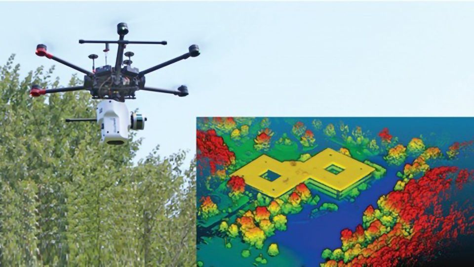
The new integrated UAV system can be equipped with a variety of hyperspectral imaging (HSI) and LiDAR sensors enabling creation of a high-resolution Digital Elevation Model (DEM) of the surveyed area. Importantly, the HSI & LiDAR sensors can be mounted onto small, lightweight drones (e.g. DJI Matrice Pro 600), which provides the freedom of flying the platform as a small unmanned aircraft (20kg or less) as designated under Civil Aviation Authority rules.
Using the new platform the HSI and DEM data can be combined into a precisely geolocated and dimensionally correct photomosaic with the reflected spectral information available at each point on the ground.
The new platform uniquely allows the precisely geolocated fusion of HSI and LiDAR data to create a 3D image in which the LiDAR measures the height of terrain and overlays it with hyperspectral images.
Ian Laidlaw, Managing Director of Analytik commented "The fusion of LiDAR with hyperspectral imaging represents a key enabling technology applicable to many remote sensing applications from civil aviation inspection to crop monitoring". He added "We have already also received interest from mining, energy and defence organisations who view that they could benefit from 3D models of terrain where accurate DEM data may not exist, such as in remote areas or in places where change occurs over time".